RD 830
Reclamation District #830
450 Walnut Meadows Drive
Oakley, CA 94561
925-625-2279
Trustees
- Jean-Marc Petit
- Domenic Cianfichi
- Tyson Zimmerman
RD 830 Events
About Reclamation District No. 830
Reclamation District No. 830 (RD 830) was formed in March of 1911 under the Reclamation District Law of 1868 for the purpose of forming a district to build levees and “reclaim” land subject to periodic overflow from neighboring rivers and water bodies. At this time the Government was promoting reclamation to develop swamp lands for the improvement and cultivation of the thousands of acres in California.
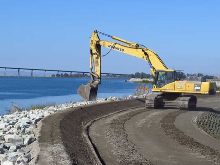
RD 830 is responsible for flood protection on Jersey Island. This is achieved through the management of sixteen miles of levees that completely surround the island as well as a network of drainage ditches. Stormwater and groundwater are collected in the drainage ditches and conveyed off the island via a pump station. RD 830 improves, maintains and repairs levees and the main drainage system of Jersey Island.
RD 830 participates in the Delta Levees Maintenance Subventions Program under the direction of the California Department of Water Resources. This program provides funding on a cost-share basis to local levee-maintaining agencies for the rehabilitation and maintenance of levees in the Delta.
What is a Reclamation District?
California Reclamation Districts are legal subdivisions within California's Central Valley that are responsible for managing and maintaining the levees, fresh water channels, or sloughs, canals, pumps, and other flood protection structures in the area. Each is run autonomously and is run by an elected board and funded with taxes to property owners in the local area. However, the Central Valley Flood Protection Board has the power to determine that a district is not satisfactorily maintaining the structures and causing the California Department of Water Resources to declare an area as a maintenance area.
What is a Levee?
A levee is an artificially constructed fill or wall, which regulates water levels. It is usually made of riprap or loose stone used to form a foundation for a breakwater or other structure. It runs parallel to the course of a river in its floodplain.
About two-thirds of the islands and tracts on the Sacramento-San Joaquin Delta are below sea level, the Delta relies on a maze of levees to protect land and key infrastructure from floods and daily high tides. In all, there are more than 1,100 miles of levees in the Delta, including many built more than a century ago to protect farmland. Were it not for these levees, the Delta would be a 740,000-acre brackish inland sea.
Links:
Budgets: See below for link to current and past RD 830 Budgets.
Bethel Island Municipal Improvement District (BIMID): BIMID was created by the State Legislature in 1960, replacing Reclamation District No. 1619. BIMID is responsible for maintaining the levees of Bethel Island, as well as distribution of water for public and private purposes, maintaining parks and playgrounds and works to provide for drainage.
RD No. 799: Link to neighboring Reclamation District 799 is the authority for Hotchkiss Tract.
RD No. 2059: Link to neighboring Reclamation District 2015 is the authority for Bradford Island.
Topoquest map: TopoQuest Map Viewer offers a USGS map of Jersey Island, CA is a island located in Contra Costa County at N38.03631° W121.68579° (NAD83)